this post was submitted on 29 Jul 2024
522 points (97.5% liked)
Map Enthusiasts
3491 readers
8 users here now
For the map enthused!
Rules:
-
post relevant content: interesting, informative, and/or pretty maps
-
be nice
founded 2 years ago
MODERATORS
you are viewing a single comment's thread
view the rest of the comments
view the rest of the comments

there was a whole hell of a or more to maps than "waking along roads". in fact, that was pretty much never a usage before cars. back then you walked roads you knew, roads with signs, or asked locals which turns to take. no one back then would take the time to make a map of their own town unless they were in a major city with many foreign travelers. remember, before the car 99% of people never left the town they were born in, and if they did they didn't go far. everyone knew their own area and the people in it. if someone saw a parson they didn't know that was often unusual and worthy of fear or suspicion.
maps were for unconquered lands. maps showed coasts and cliffs and forests. maps showed ports and currents and climates. they showed enemy positions they showed friendly taverns they showed where you weren't welcomed.
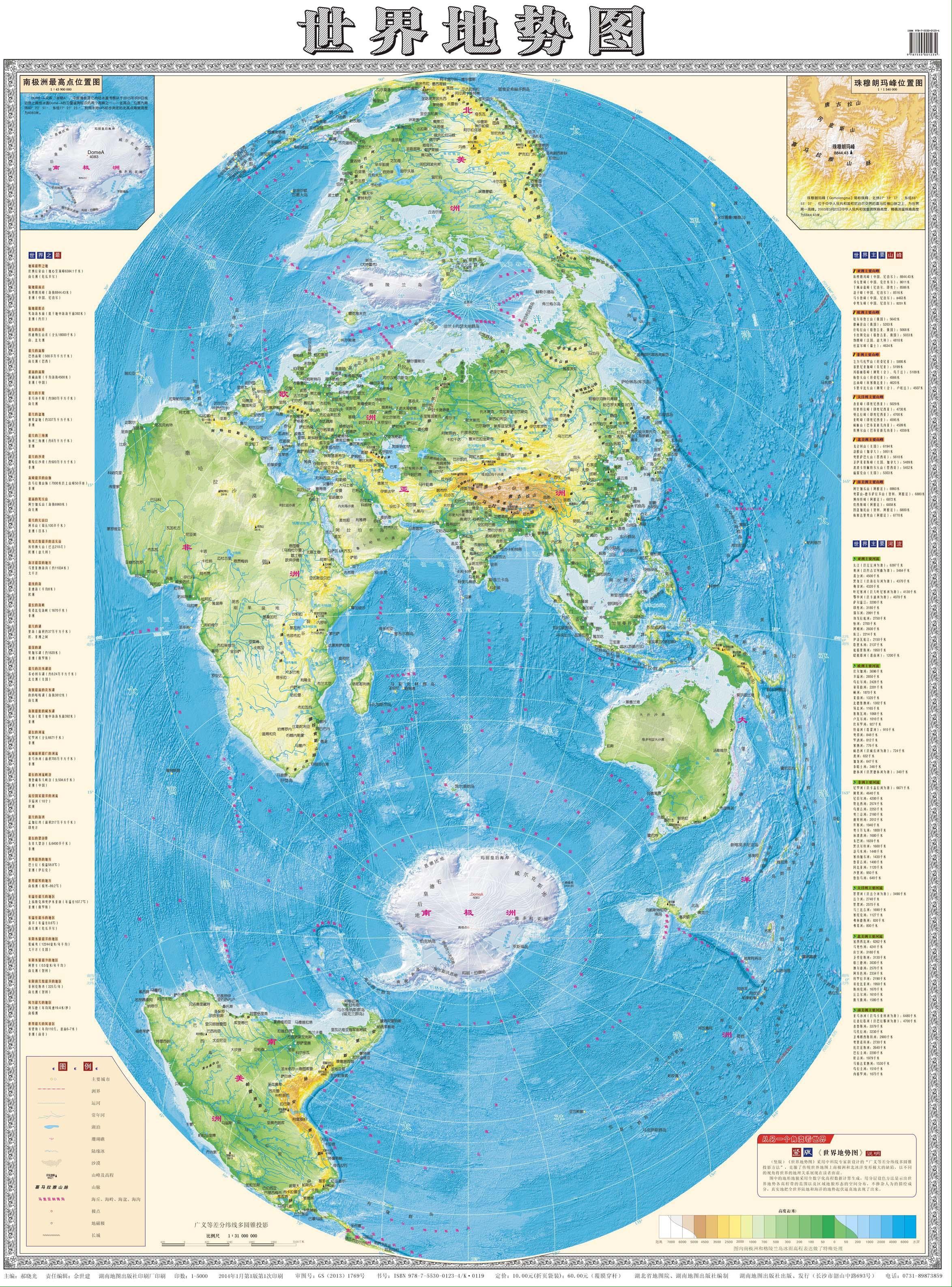
maps are not useful when vague beyond sating curiosity. an imprecise map was the result of many many deaths at sea. a ship's pilot back in the day (the navigator, kind of) would have a trove of maps and journals he inherited from The one he apprenticed under. some of those journals were the most valuable books in all human history. they created all international trade for centuries. these were basically very very long detailed turn by turn directions to get from Port to Port. like "depart from malaga Port heading 12.3 degrees west. there's a warm current for miles north of there during the months of summer. avoid it." things like that. they didn't necessarily get all that caught up by the whole roundness thing. they did it all by hands measuring distance and direction. what they struggled with was the accurate keeping of time to use the sun and stars to determine angle and latitude. the curvature of the earth is really only a massive problem in making world maps. even a map of all of China is barely affected by the curvature. world maps have always been vague because they're zoomed out too far to make out important details.
That was a fun read