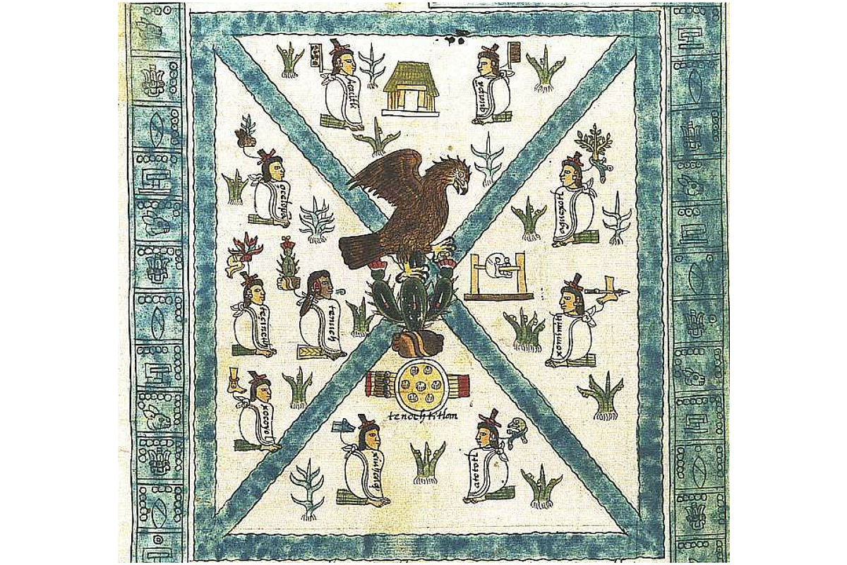
1325 According to legend, Tenochtitlan is founded on this date on an island in what was then Lake Texcoco in the Valley of Mexico.
Tenochtitlán, located on an island near the western shore of Lake Texcoco in central Mexico, was the capital city and religious centre of the Aztec civilization. The traditional founding date of the city was 1345 CE and it remained the most important Aztec centre until its destruction at the hands of the Spanish led by Hernán Cortés in 1521 CE, which led to the final collapse of the Triple Alliance. At the heart of the city was a large sacred precinct dominated by the huge pyramid, known as the Temple Mayor, which honoured the gods Huitzilopochtli and Tlaloc. The site, now Mexico City, continues to be excavated and has yielded some of the greatest treasures of Aztec art such as the celebrated Sun Stone as well as art objects the Aztecs themselves collected from the other great civilizations of Mesoamerica.
Tenochtitlan was one of two Mexica āltepētl (city-states or polities) on the island, the other being Tlatelolco.
Story
The story of the founding of Tenochtitlan has survived through time thanks to several historical documents, such is the case of the Mexican Chronicle that was written by Hernando de Alvarado Tezozómoc in the sixteenth century.
As such, it can be pointed out that the emergence of Tenochtitlan began with the migration process of the Aztecs, who received that name for inhabiting the land of Aztlan, where they worshipped Huitzilopochtli, the deity that would guide them to a new place. The Aztecs were not the only nahuan tribe that undertook this migration process because, as Hernando de Alvarado Tezozómoc refers, there were seven neighborhoods, each one identified by a deity.
"Each one brought the name of its God, such as Quetzalcoatl, Xomoco, Matla, Xochiquetzal, Chichiltic, Zentutl, Piltzinteuctli, Meteutl, Tezcatlipuca, Mictlatleuctli, and Tlamacazqui, and other Gods".
The migration process took several years before reaching the Basin of Mexico, passing through various places and settlements where they settled as they were people who knew and practiced agriculture, however, they were also people dedicated to war, As Tezozómoc refers in the myth of Malinalxóchitl, when the Aztecs abandoned Malinalxóchitl, they did so by the will of Huitzilopochtli, who was in charge of bringing weapons, bows, arrows and bucklers, as his main occupation was war.
This same, led to that the Mexica could subdue the other neighborhoods that had come out of the seven caves, achieving that their deity of Huitzilopochtli was imposed before the other gods. Likewise, they gained a notable reputation in the battlefield, which allowed them to perform as warriors for other towns, as it was the case of the Tepaneca Tezozómoc's lordship who in exchange for their services allowed them to settle in a lake islet.
However, the Mexica alliance with the Tepanecas ended in 1428 with the rebellion of a group of Tenochcas led by the aforementioned Itzcóatl. The victory of the Mexica gave way to the rise and hegemony of the Mexica empire over the Basin of Mexico, which came to an end in 1521 with the fall of Mexico-Tenochtitlan in the hands of the Spanish conquerors, however, figures such as Hernando de Alvarado Tezozómoc managed to preserve the history of the Mexica.
With Tenochtitlan in ruins, the victorious Cortés first settled himself in Coyoacán on the lake shore at the southern edge of Lake Texcoco. He created the ayuntamiento or town council of the Spanish capital there, so that he could choose where the city would finally be.
For much of the colonial period, parts of Mexico City would remain very indigenous in character, with elements of these cultures surviving into modern times. Two separate parts of the capital were under indigenous rule, San Juan Tenochtitlan and Santiago Tlatelolco, with Nahua governors who were intermediaries between the indigenous population and the Spanish rulers, although the capital was designated a ciudad de españoles (Spanish city)
Between late 1521 and mid-1522, Alonso García Bravo and Bernardino Vázquez de Tapia were tasked with the layout of the new Spanish city. The Spaniards decided to keep the main north–south and east–west roads that divided the city into four and the boundaries of the city were set with an area of 180 hectares, which was divided into 100 blocks. There were eight principal canals in the Aztec city, including the one that ran on the south side of the main plaza (today Zócalo), which were renamed
Around the main plaza, which became the Plaza Mayor or Zócalo in the colonial period, Cortés took over what were the "Old Houses" of Axayacatl and the "New Houses" of Moctezuma, both grand palaces, for his own. Other conquistadors of the highest rank took positions around this square.
The Spaniards began to build houses, copying the luxury residences of Seville. Being of firmer ground and less subject to subsidize, the area east of the main plaza was built up first, with the lake's waters up against the walls of a number of these constructions. The west side grew more slowly as flooding was more of an issue, and it was farther from the city's docks that brought in needed supplies.
The Spanish may well have found "Tenochtitlan" hard to say. They did shift the accent from Nahuatl pronunciation from Tenochtítlan (with the standard emphasis on the penultimate syllable) to Tenochtitlán. and eventually adopted the city's secondary name "Mexico", the "place of the Mexica" or Aztecs. For a period, the city was called by the dual name Mexico-Tenochtitlan, but at some point, the capital of the viceroyalty's name was shortened to Mexico. The name "Tenochtilan" endured in one of the capital's two indigenous-ruled sections, known as San Juan Tenochtitlan
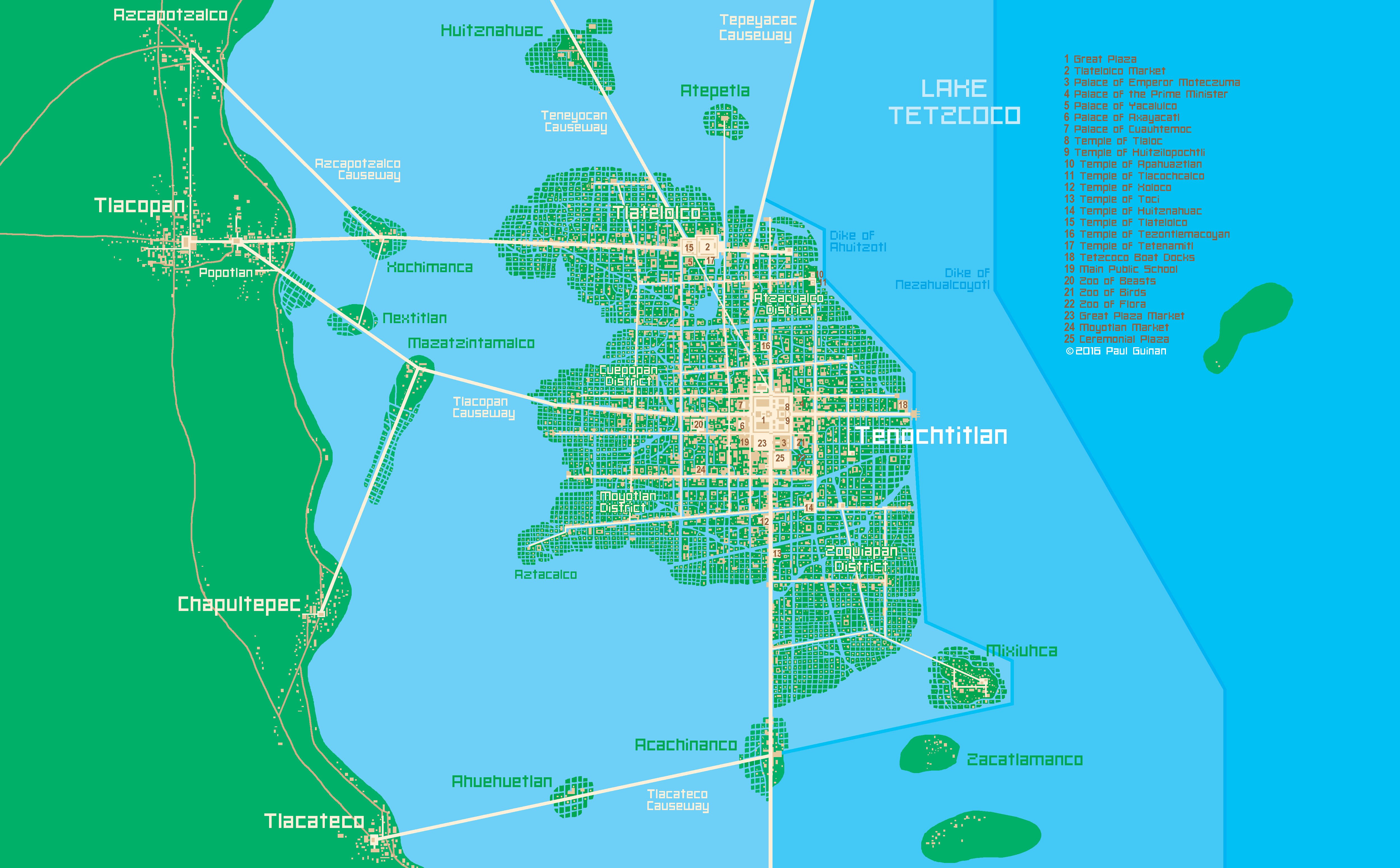
Reconstruction of Tenochtitlan

Megathreads and spaces to hang out:
- 📀 Come listen to music and Watch movies with your fellow Hexbears nerd, in Cy.tube
- 💖 Come talk in the New Weekly Queer thread
- 🔥 Read and talk about a current topics in the News Megathread
- ⚔ Come talk in the New Weekly PoC thread
- ✨ Talk with fellow Trans comrades in the New Weekly Trans thread
reminders:
- 💚 You nerds can join specific comms to see posts about all sorts of topics
- 💙 Hexbear’s algorithm prioritizes comments over upbears
- 💜 Sorting by new you nerd
- 🌈 If you ever want to make your own megathread, you can reserve a spot here nerd
- 🐶 Join the unofficial Hexbear-adjacent Mastodon instance toots.matapacos.dog
Links To Resources (Aid and Theory):
Aid:
Theory:


Saw something about how even civilian parts of the US government like NASA and the NPS have ties to the evil murder regime, and it reminded me of something.
The National Park Service in some places like along the Blue Ridge Parkway uses a symbol of a rifle and a powder horn on signs, the weapon used to genocide Native Americans.
It’s like if the German Park Service used a Zyklon B canister on their signage. It’s vile.
A lot of the national parks had indigenous people living in them when they were established. Some people were forced out at gunpoint, others became de-facto zoo exhibits. The national parks "vast, untouched wilderness" that was actually people's homes is an important myth for modern Americans that helps bury the truth of indigenous genocide. Love me some parks, but the system itself was absolutely part of finalizing and then denying the genocide of indigenous people. Just ask yourself why there is an Arapaho National Forest in Colorado when most of the Arapaho were forced out of that state at gunpoint over a century ago and a lot of things become clear.
Settlers fucking love naming shit after people they stole it from by killing or displacing them
Oooh, look at this mangled (probably filtered through fucking French or something) indigenous name we gave our place, look how quaint and historical we are!!